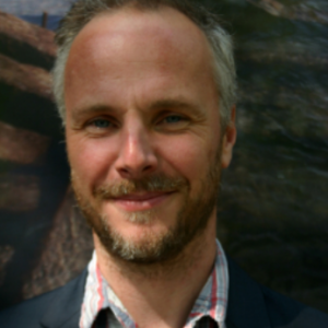
Brandon Mason
Business Development, Underwater Archaeologist,
Technical Lead
Brandon is trained maritime archaeologist with over 15 years’ experience of research, commercial consultancy and visualisation working in the underwater, intertidal and coastal zones.
Since joining the Maritime Archaeology Trust full-time in 2008, Brandon has developed the organisation’s capacity for digital visualisation and interactive interpretation (HLF funded Archiving Invincible (1758) project; Interreg IVa Atlas of the 2 Seas (2012),; ArchManche (2013)); Langstone Harbour 3D Viewer 2014; HLF Forgotten Wrecks of the First World War (2014 – 2018); HMT Arfon virtual dive (Historic England, 2017); Chesil Cannon Sites Virtual Dive Trail (2021). These sites are supplemented by the numerous artefacts and reconstructions accessible via our public gallery (sketchfab.com/maritimearchaeologytrust).
Brandon has recently utilised the potential of AUVs for surveying deep water wrecks (Catcher Area, North Sea (2014, 2021)) and UAVs for recording and analysis of prehistoric sites across the UK, Brittany and northern Spain (Common Cultural Connections (2016)/Forgotten Wrecks (2018)/North-west Solent (2021) including the further enhancement and analysis of data outputs in GIS and a variety of 3D modelling software packages. This complements his experience in processing and visualisation large volume geophysical and bathymetric data sets for offshore commercial projects.
Brandon has developed his commercial experience and skill set working for a variety of clients and in collaboration with a range of stakeholders including curators, specialists and members of the public involved throughout the EIA process. This work has been conducted on behalf of Maritime Archaeology Ltd (MA Ltd) in a commercial environment, and also with the Maritime Archaeology Trust in a research capacity. Brandon delivers on a wide range of projects within the marine, inter-tidal and terrestrial zones, including archaeological consultancy, Written Schemes of Investigation, detailed Method Statements, bespoke protocol documents, in addition to his full range of desk based assessment, marine geophysical survey interpretation, watching briefs and excavation and foreshore and diving investigation skills.
Skills
- Database Development
- GIS Analysis
- 3D Visualisation
- Marine Geophysics
- Remote Sensing (Including Aerial/Drones)
- Research/Publications
- Geophysical Data Processing/Interpretation
- Underwater Excavation
- Underwater Photogrammetry
- Underwater Survey
Languages
English


