| ID |
Project Main Image |
Org ID |
Project Name |
Project URL |
Project Description |
Latitude (WGS84) |
Longitude (WGS84) |
Project Report |
Video URL |
Record Created |
Record Creator |
Location |
Project SDGs |
|
12
|

|
CINDAQ - Centro Investigador del Sistema Acuifero de Quintana Roo A.C.
|
Sagitario La Mina
|
https://www.cindaq.org/copy-of-sagitario-la-mina
|
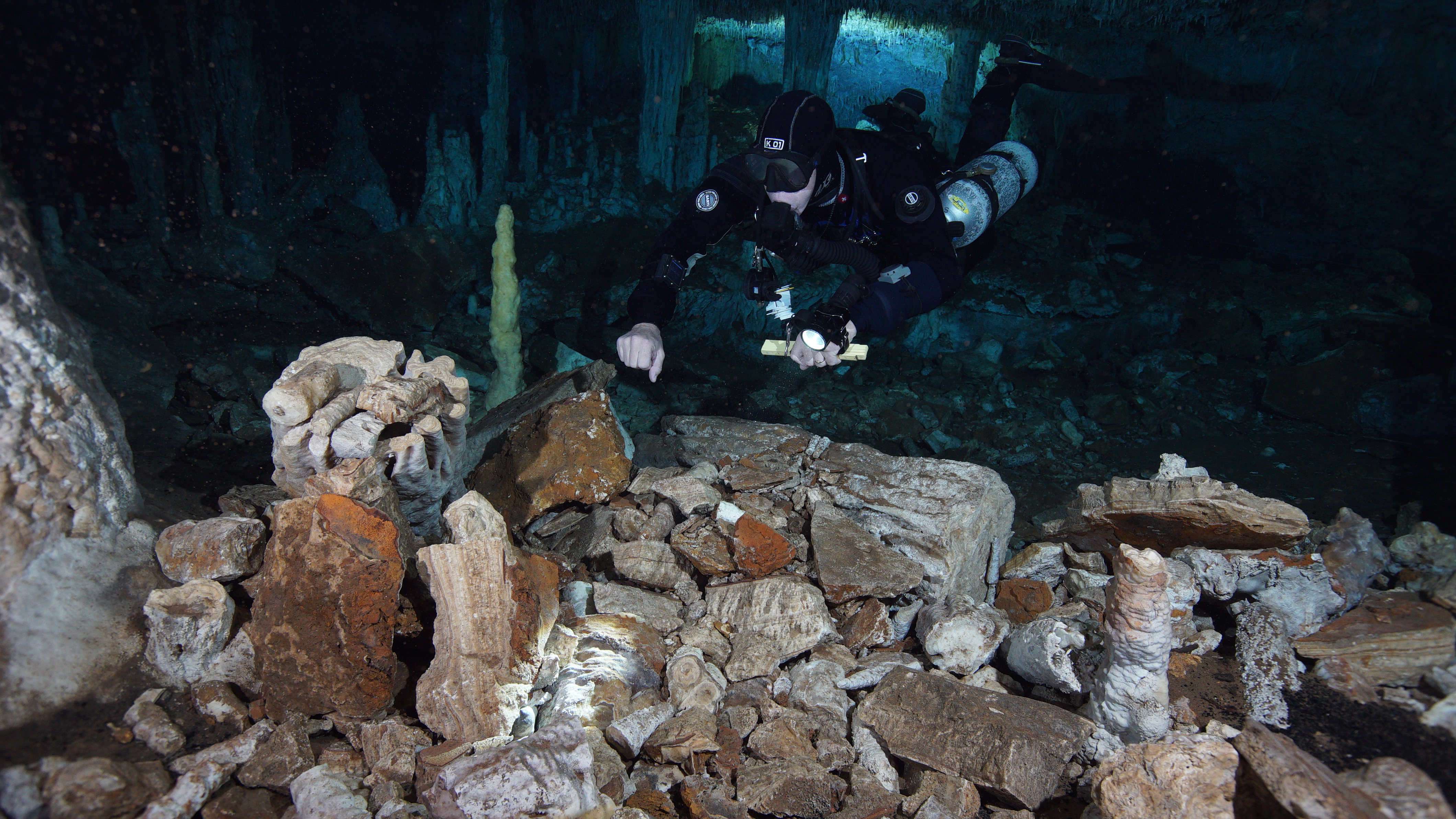
In 2017, CINDAQ's dive team found evidence of ancient mining activity while exploring and mapping new tunnels of an underwater cave near Akumal, Quintana Roo, Mexico.
The Maya are known to have actively mined pigment and other minerals from the caves of the Yucatan Peninsula, but the ancient mines discovered by the CINDAQ team are now submerged, indicating that such mineral exploitation occurred thousands of years ago. At the end of the last Ice Age, intrepid miners ventured deep into these tunnels with torches in hand. The navigational markers, mining debris, fire pits and excavation pits they left behind are now entirely underwater.
In coordination with INAH-SAS, CINDAQ's team performed more than 100 dives, totaling nearly 600 diver hours underwater to create a detailed map of the site. An additional 100 diver hours were dedicated to acquiring the nearly 18,000 images used for the 3D photogrammetric models, which are enabling researchers to “virtually” access and study this remote subterranean mining complex.
The results were published in 2020 in Science Advances.
|
20.6000
|
-87.4000
|
science_advances_lamina.pdf
|
https://www.youtube.com/watch?v=wJL5mBCP4ZU&t=2s
|
2022-07-28 19:54:41
|
cindaq
|
Mexico
|
|

