| ID |
Project Main Image |
Org ID |
Project Name |
Project URL |
Project Description |
Latitude (WGS84) |
Longitude (WGS84) |
Project Report |
Video URL |
Record Created |
Record Creator |
Location |
Project SDGs |
|
13
|
|
Maritime Archaeology Trust
|
Rising from the Depths - Salary Bay, Madagascar
|
https://risingfromthedepths.com/innovation-projects/marovany-4-4/
|
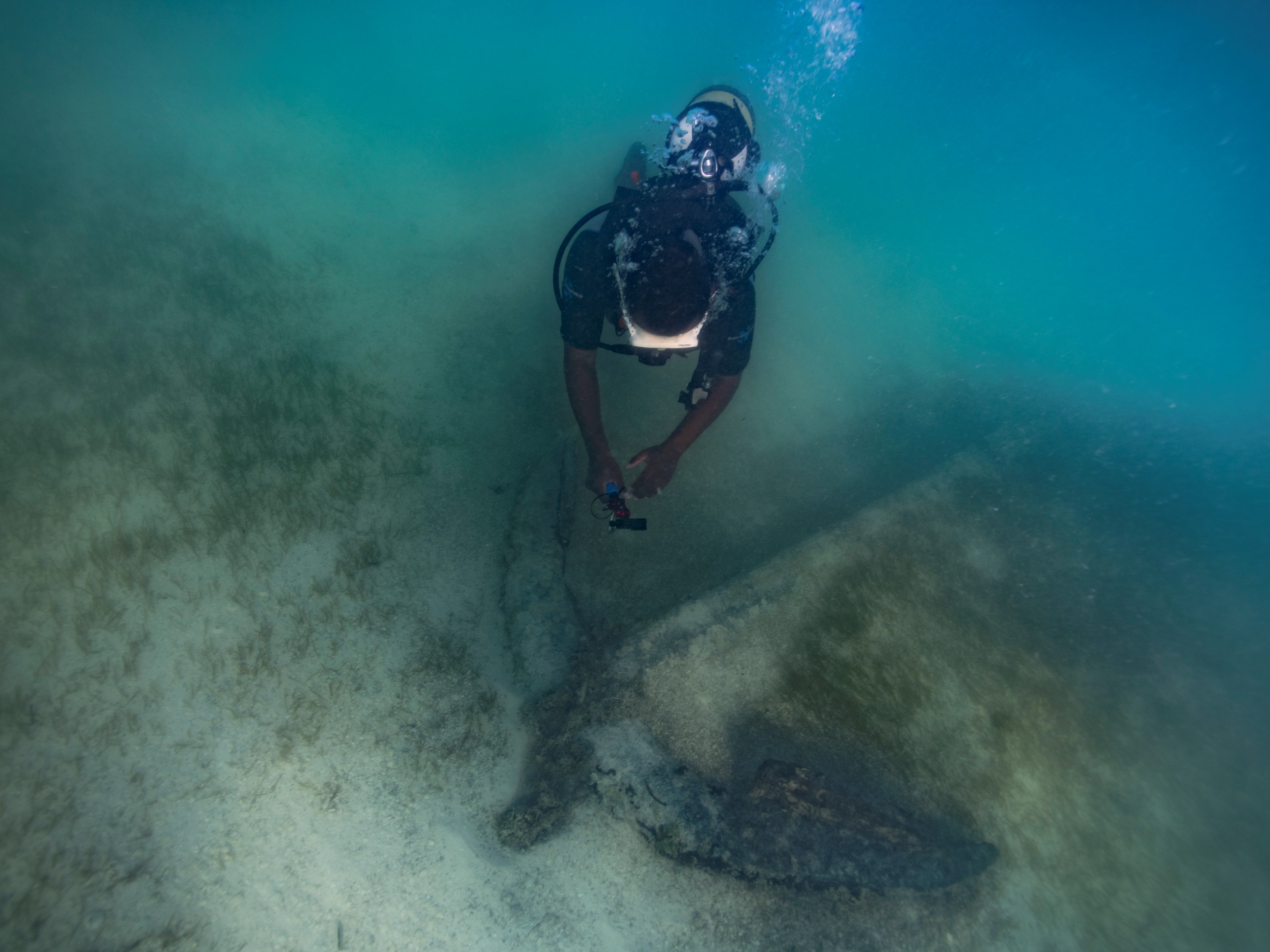
STUDY AND IMPLEMENTATION OF NETWORK SYSTEM BY FISHERS’ COMMUNITY ACTOR FOR THE MARINE CULTURAL HERITAGE SURVIVAL. CASE OF THE FARMING TOWNSHIP OF TSIFOTA IN SOUTHWEST OF MADAGASCAR RFTD MARKER
Study and implementation of network system by fishers’ community actor for the marine cultural heritage survival. Case of the farming township of Tsifota in Southwest of Madagascar, Rabekoto Andrinjarisoa Heritiana, Association Marovany.
|
-22.5498
|
43.2240
|
NULL
|
NULL
|
2023-06-12 16:59:50
|
brandon.mason@maritimearchaeology.co.uk
|
Madagascar
|
|
|
12
|
|
CINDAQ - Centro Investigador del Sistema Acuifero de Quintana Roo A.C.
|
Sagitario La Mina
|
https://www.cindaq.org/copy-of-sagitario-la-mina
|
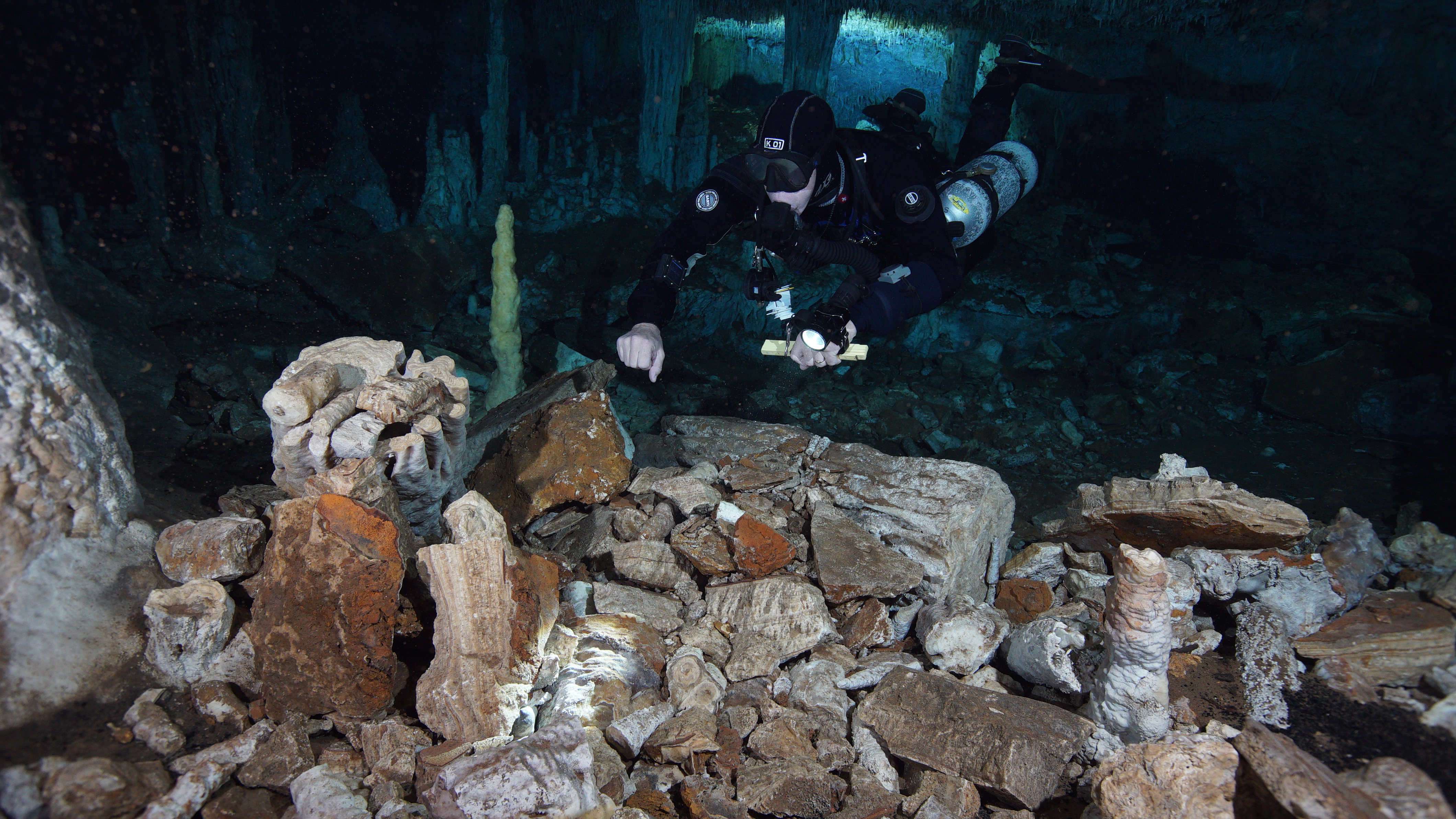
In 2017, CINDAQ's dive team found evidence of ancient mining activity while exploring and mapping new tunnels of an underwater cave near Akumal, Quintana Roo, Mexico.
The Maya are known to have actively mined pigment and other minerals from the caves of the Yucatan Peninsula, but the ancient mines discovered by the CINDAQ team are now submerged, indicating that such mineral exploitation occurred thousands of years ago. At the end of the last Ice Age, intrepid miners ventured deep into these tunnels with torches in hand. The navigational markers, mining debris, fire pits and excavation pits they left behind are now entirely underwater.
In coordination with INAH-SAS, CINDAQ's team performed more than 100 dives, totaling nearly 600 diver hours underwater to create a detailed map of the site. An additional 100 diver hours were dedicated to acquiring the nearly 18,000 images used for the 3D photogrammetric models, which are enabling researchers to “virtually” access and study this remote subterranean mining complex.
The results were published in 2020 in Science Advances.
|
20.6000
|
-87.4000
|
science_advances_lamina.pdf
|
https://www.youtube.com/watch?v=wJL5mBCP4ZU&t=2s
|
2022-07-28 18:54:41
|
cindaq
|
Mexico
|
|
|
6
|

|
ADRAMAR
|
The reconstructed archaeological site of Bizeux
|
https://adramar.fr/plongee-sur-le-site-archeologique-reconstitue-de-bizeux/
|
The reconstructed archaeological site of Bizeux presents an 18th century privateer wreck. We discover in scuba diving or in apnea, five guns, two arranged in ballast, three arranged in battery for defensive fire; a jas anchor. This reconstructed archaeological site with real artefacts is open to all audiences. It allows direct contact with the historical submerged Breton heritage for all audiences who master swimming.
|
48.6283
|
-2.0267
|
NULL
|
NULL
|
2021-06-10 12:53:40
|
HOYAU BERRY Anne
|
France
|
NULL
|
|
5
|

|
ADRAMAR
|
Epave du Fetlar
|
https://play.google.com/store/apps/details?id=fr.eesab.dpn.fetlard&hl=fr&gl=US
|
3D scanning of the wreck of the Fetlar, wrecked in 1919, off Saint-Malo (Brittany, France). The photogrammetry technique allowed a 3D rendering of the wreck and the implementation of an immersive virtual dive. This technique also allows the archaeological recording of the wreck.
|
48.6845
|
-2.0727
|
NULL
|
NULL
|
2021-06-10 13:07:39
|
HOYAU BERRY Anne
|
France
|
NULL
|
|
25
|

|
MaritimEA Research
|
Digital Heritage Trails Project
|
http://www.lostcitiesofthedelta.org
|
MaritimEA is undertaking a project titled “The Digital Heritage Trails Project” (DHTP). The project involves the documentation of endangered archaeological sites in the Indus Delta region, including Banbhore, Ratukot, Jam Jaskar Goth, Ranokot, and Lahiri Bandar. DHTP has developed high-precision 3D representations, or "digital copies", of these sites to support effective site management, heritage conservation efforts, and climate impact mitigation.
The project has also created a digital heritage trail called the “Lost Cities of the Indus Delta”. The heritage trail is an exciting and innovative explorative experience, curated to provide a general public audience with an online, interactive, and immersive experience, while exploring the rich history of the Indus Delta region.
MaritimEA is joined by partner organisations, Kaspar Consulting and Apparatus/Chrononaut, in developing the project with the generous support of the Cultural Protection Fund, British Council and the UK Department of Culture, Media & Sport.
View the Heritage Trail at www.lostcitiesofthedelta.org.
|
24.7516
|
67.5227
|
NULL
|
https://youtu.be/y31ZkwD1jO8
|
2025-03-26 02:48:10
|
Amer Bazl Khan
|
Pakistan
|
|
|
8
|
|
Institute of Nautical Archaeology
|
Ancient and Early Modern Shipwrecks in the Mediterranean
|
https://nauticalarch.org/projects/
|
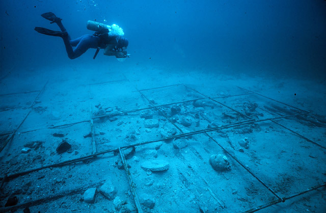
The Institute of Nautical Archaeology has been actively excavating shipwrecks in the Mediterranean for more than four decades. Notable shipwrecks include those at: Cape Gelidonya, Uluburun, Pabuç Burnu, Tektaş Burnu, Yassıada, Kizilburun, and Serçe Limani. Many of these shipwrecks are displayed in the Bodrum Museum of Underwater Archaeology. INA archaeologists operate from INA's Bodrum Research Center (BRC), which houses offices, artifact and wood conservation laboratories, a dormitory, and a 10,000 volume research library.
|
37.0344
|
27.4305
|
NULL
|
NULL
|
2021-07-19 16:51:35
|
ina
|
Turkey
|
|
|
22
|
NULL
|
Rhode Island Marine Archaeology Project
|
The Vessels Lost in RI during the Revolutionary War - Part III
|
https://www.rimap.org/the-other-vessels
|
RIMAP’s study of the Newport transport fleet has generated a great amount of international interest in local maritime history because one of the vessels, the Lord Sandwich, had been Capt. Cook’s Endeavour Bark of his first circumnavigation. RIMAP’s historical studies of the transports overturned the 170-year-long history of where the Endeavour was to be found in Newport Harbor, and RIMAP’s archaeological investigations have focused on a group of five sites, one of which might be that iconic vessel. Continued RIMAP fieldwork has not generated adequate proof that one site, RI 2394, is the Endeavour, to the disappointment of others interested in Cook and his explorations. At the end of this study, and following UNESCO and State protocols, RIMAP has properly closed RI 2394 and recommends that RI 2394 not be reopened without a valid scientific reason. The various phases of these transport studies have been documented in multiple publications, presentations, and videos, and all reports are available for free download on the www.rimap.org website.
On the advice of the SHPO (State Historic Preservation Office) coordinates are redacted.
|
0.0000
|
0.0000
|
NULL
|
NULL
|
2024-06-03 23:51:09
|
snelsonmaney
|
United States of America
|
 ,  |
|
21
|
NULL
|
Rhode Island Marine Archaeology Project
|
The Vessels Lost in RI during the Revolutionary War - Part II
|
https://www.rimap.org/the-other-vessels
|
RIMAP’s very first archaeological fieldwork in 1993 was a sonar survey to locate the fleet of 13 privately-owned British transports scuttled in Newport’s Outer Harbor August 5-9, 1778, in the days leading up to the Battle of Rhode Island in the American Revolution. In the years since, continued remote sensing, diver ground-truthing, plus background historical research, have located and created pre-disturbance maps of 10 of these vessels. RIMAP volunteers, under professional direction, have conducted test excavations at three of these sites. Although the identification of each ship in each site is still unclear, and although less is known about the history of these commercial vessels than the more glamorous naval ships, RIMAP’s studies have demonstrated their significance for the outcome of that war.
On the advice of the SHPO (State Historic Preservation Office) coordinates are redacted.
|
0.0000
|
0.0000
|
NULL
|
NULL
|
2024-06-03 23:49:42
|
snelsonmaney
|
United States of America
|
 ,  |
|
20
|
NULL
|
Rhode Island Marine Archaeology Project
|
The Vessels Lost in RI during the Revolutionary War - Part I
|
https://www.rimap.org/the-other-vessels
|
RIMAP’s early studies of the ships lost in local waters during the American Revolution included preliminary studies of HMS Lark, Cerberus, and Orpheus, three of the four Royal Navy frigates intentionally destroyed along the western shore of Aquidneck Island on August 5, 1778. Sonar searches to find HMS Juno in Coddington Cove were not successful, but the sub-bottom survey suggested the presence of one ship that was not confirmed, and that could be one of two British transport/victuallers that were also lost there at the same time. The RIMAP partners for these studies were the US Navy and the Naval Undersea Warfare Center. The Office of Naval Research and NOAA sponsored a special remote sensing demonstration that featured RIMAP’s work on these Royal Navy sites, and their video was titled “Partnerships Run Deep.”
On the advice of the SHPO (State Historic Preservation Office) coordinates are redacted.
|
0.0000
|
0.0000
|
NULL
|
NULL
|
2024-06-03 23:48:10
|
snelsonmaney
|
United States of America
|
 ,  |
|
19
|
NULL
|
Rhode Island Marine Archaeology Project
|
Newport's Brenton Cove
|
https://www.rimap.org/the-other-vessels
|
There are four vessels known to have been abandoned in Newport’s Brenton Cove, one of which was the reputed Slave Ship Gem. RIMAP teams described the physical remains of these ships, including the one insecurely identified as a slaver that was abandoned there after the Civil War. Historical studies suggested that slaving was not the Gem’s history, but the study also illustrated the emotional relationship of Rhode Island as the apex of the triangle trade between Africa, the Caribbean, and Rhode Island. The results were published in the SHA/ACUA proceedings.
On the adice of the SHPO (State Historic Preservation Office) coordinates are redacted.
|
0.0000
|
0.0000
|
NULL
|
NULL
|
2024-06-03 23:46:26
|
snelsonmaney
|
United States of America
|
 ,  |
|
18
|
NULL
|
Rhode Island Marine Archaeology Project
|
RI 2130 - The Fort Adams Marine Railway
|
https://www.rimap.org/new-page
|
Fort Adams is an early 19th-century US Army fort that in the 20th century sponsored a shipyard to repair and service the vessels that supported the troops stationed there. The shipyard included a marine railway used to draw out of the water craft as long as 100’ and after repair to return them to active service. The marine railway was built before the Korean War by Newport’s Crandall Shipyard, known in the 19th-century for building ocean going vessels. That business is now a major marine engineering firm located in Boston, and the original construction documents are still housed in the firm’s archives. RIMAP field teams compared the railway’s current structural details with the original marine railway specifications and has documented the continuing site disturbance by natural and human causes.
On the advice of the SHPO (State Historic Preservation Office) coordinates are redacted.
|
0.0000
|
0.0000
|
NULL
|
NULL
|
2024-06-03 23:43:55
|
snelsonmaney
|
United States of America
|
 ,  |
|
17
|
NULL
|
Rhode Island Marine Archaeology Project
|
The Ships of Namquid/Gaspee Point
|
https://www.rimap.org/the-other-vessels
|
Rhode Island patriots attacked and burned HMS Gaspee in 1772 in response to increasing British interference in local trade. RIMAP began a study of this area in 2015, starting with two 19th-century vessels in the area. As part of its citizen scientist training program, the teams documented the current conditions and natural destruction of these sites. For the 250th anniversary of the burning of the Gaspee, local businesses and individuals supported RIMAP’s conclusive study of the spit where the vessel was known to have gone aground and was burned. RIMAP assembled experts to conduct the side scan sonar, sub bottom, and magnetometry surveys of the area in 2021-2. RIMAP volunteer divers ground-truthed the targets generated by those data in 2021-3 and the RIMAP land team volunteers established a research station on the nearby shore to manage the related shallow-water and land-side investigation. This effort was promoted as an opportunity for the public to observe the archaeological teams at work. Multiple presentations, publications, and a video document the various phases of this project, and RIMAP created an exhibit at the Warwick Public Library about its studies at Gaspee Point.
On the advice of the SHPO (State Historic Preservation Office) coordinates are redacted.
|
0.0000
|
0.0000
|
NULL
|
NULL
|
2024-06-03 23:39:06
|
snelsonmaney
|
United States of America
|
 ,  |
|
9
|
|
Institute of Nautical Archaeology
|
Shipwrecks in North America and the Caribbean
|
https://nauticalarch.org/projects/
|
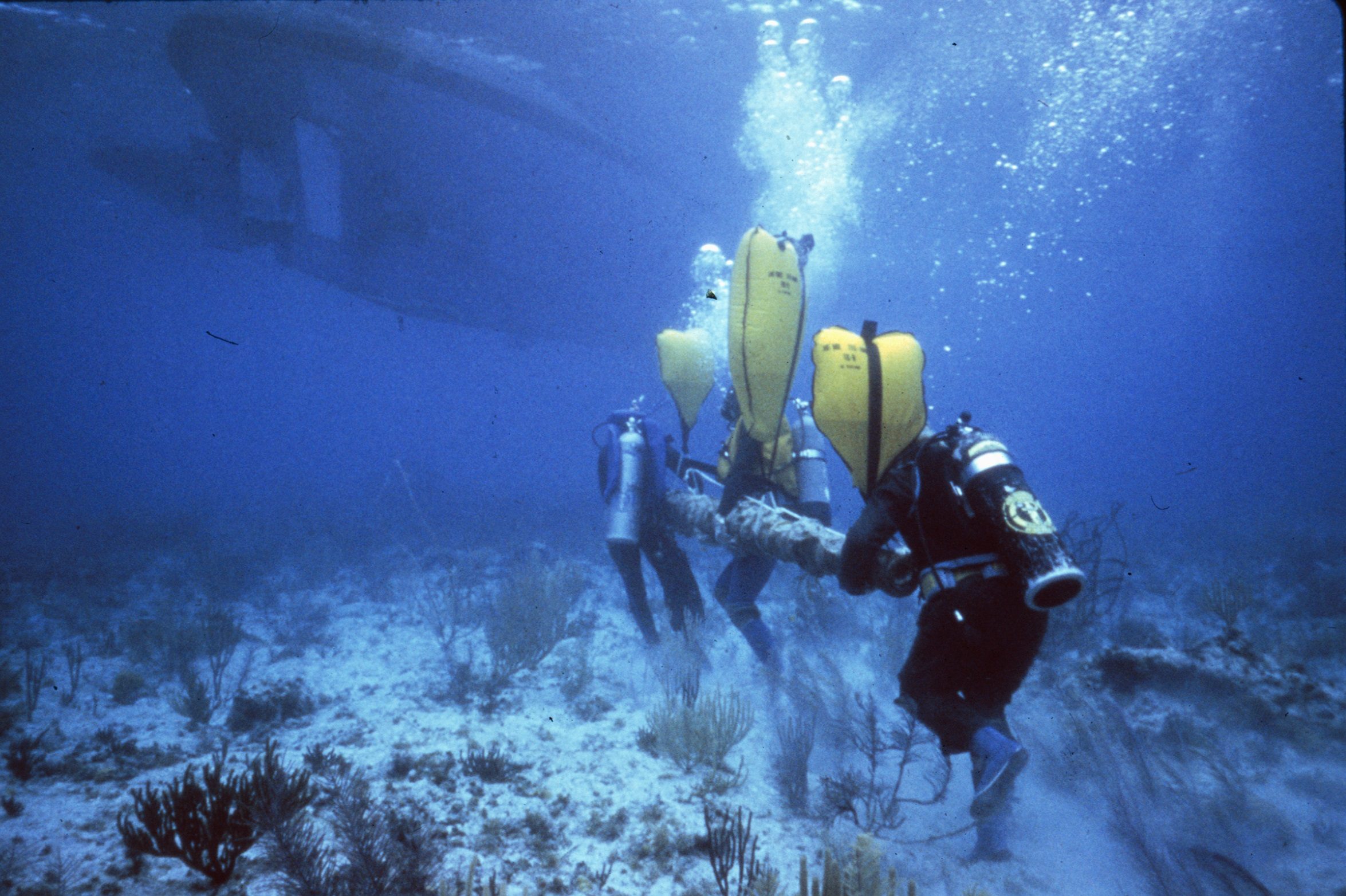
Since the 1970s, the Institute of Nautical Archaeology has sponsored and/or directed many underwater excavations in North America and the Caribbean, including those at: Port Royal (Jamaica), Molasses Reef (Turks and Caicos), Rockley Bay (Tobago), Monte Cristi (Dominican Republic), Red River (Oklahoma), and Lake Champlain (Vermont). Since 1976, the INA headquarters have been located on the campus of Texas A&M University. Many INA officers are also faculty in the graduate Nautical Archaeology Program at Texas A&M.
|
30.6188
|
96.3365
|
NULL
|
NULL
|
2021-07-19 13:36:33
|
ina
|
United States of America
|
|
|
16
|

|
Nautical Archaeology Society
|
International Training Partner Scheme
|
https://www.nauticalarchaeologysociety.org/Pages/Category/international-system
|
We support organisations from around the world in teaching best practices in underwater cultural heritage through our International Training Partner Programme. These organisations have a licence to teach a local version of our accredited training programme which has a core module on UCH legislation including information about the 2001 Convention. There are currently 25 organisations in this programme and 7 of them are from countries that have ratified the 2001 Convention.
|
50.7888
|
-1.0319
|
NULL
|
NULL
|
2023-08-24 13:51:10
|
Peta Knott
|
United Kingdom
|
|
|
15
|

|
Nautical Archaeology Society
|
Identifying Explosive and Environmental Hazards on Wrecks
|
https://moodle.nauticalarchaeologysociety.org/
|
Learn how to safely dive on military wrecks and help to identify environmental and explosive hazards on wrecks. This course is a pre-requisite for NAS MOD diving projects.
|
50.7888
|
-1.0319
|
NULL
|
NULL
|
2023-08-24 13:38:24
|
Peta Knott
|
United Kingdom
|
|
|
14
|
|
Nautical Archaeology Society
|
HMS Natal
|
https://www.nauticalarchaeologysociety.org/mod-wreck-assessments
|
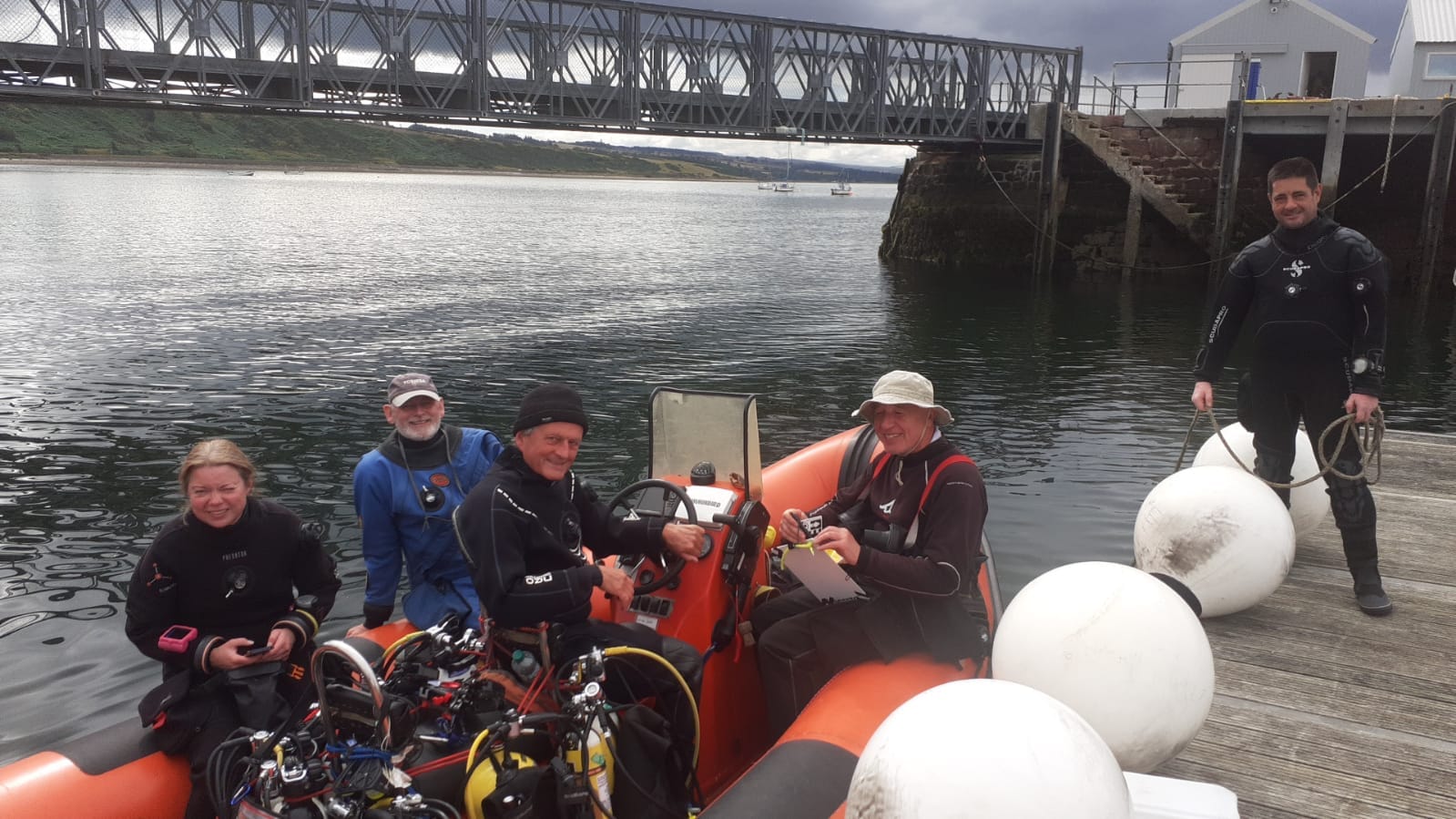
The Ministry of Defence (MOD) has multiple historic shipwrecks in UK waters and little is known about the condition of many of these wreck sites. Consequently, the Nautical Archaeology Society (NAS) carried out a programme of non-intrusive condition assessments using the HMS Natal in the Cromarty Firth, Scotland as a pilot project.
The condition assessments for all future wrecks will follow the same format, using a pro-forma to ensure that there will be consistency in assessment and ongoing monitoring to determine the condition of the wrecks over time. The assessment will highlight such aspects as the collapse or otherwise of the structure, obvious examples of environmental pollution, anchor and fishing net damage and any salvage or collection of artefacts that has previously occurred.
|
57.6959
|
-4.0891
|
NULL
|
NULL
|
2023-08-24 13:29:44
|
Peta Knott
|
United Kingdom
|
|
|
4
|
|
Maritime Archaeology Trust
|
Chesil Beach Project
|
https://www.nauticalarchaeologysociety.org/chesil-beach-protected-wrecks
|
Chesil Beach Protected Wrecks Community Archaeology Project
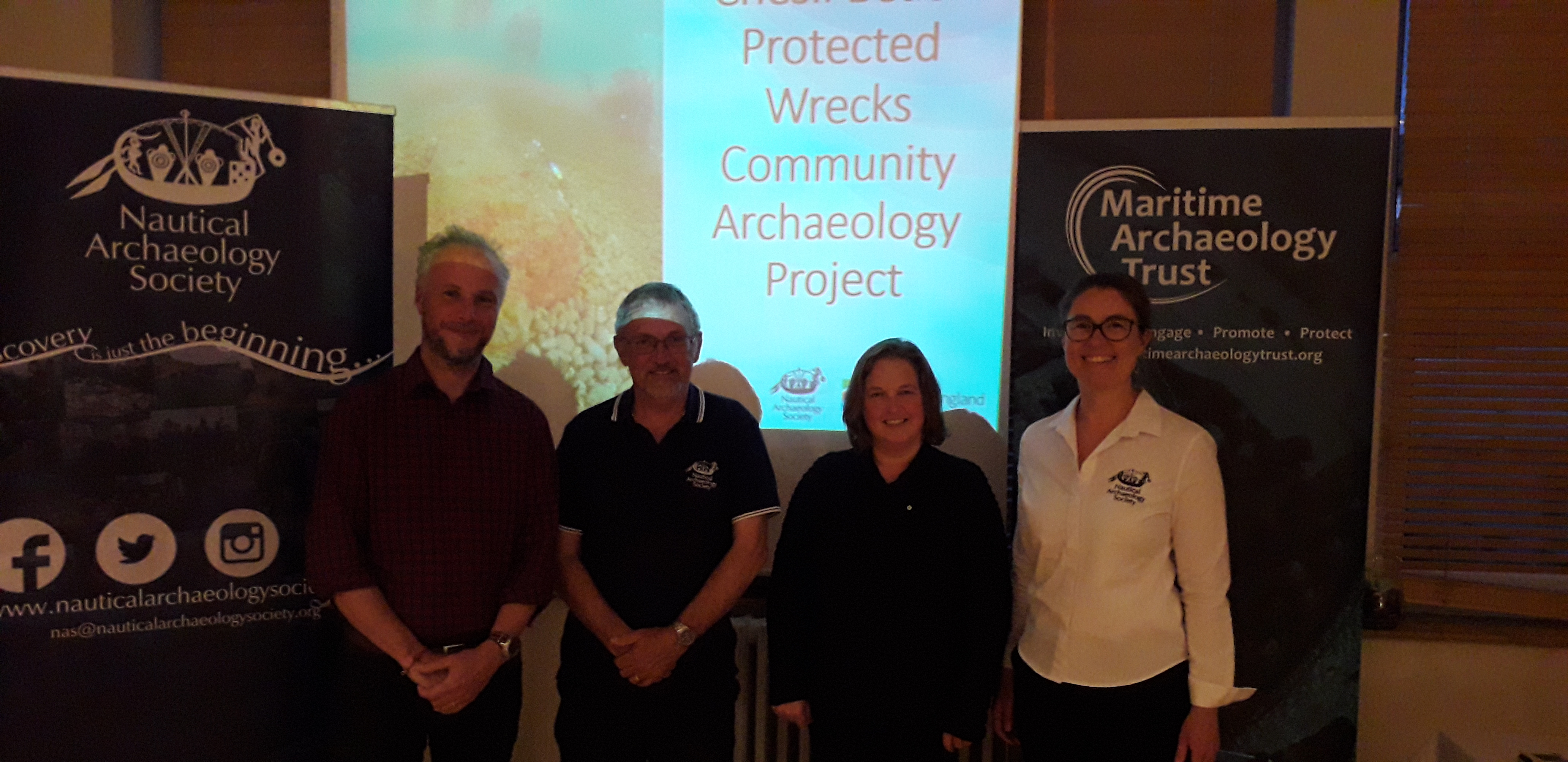
In 2019 the Nautical Archaeology Society (NAS) and the Maritime Archaeology Trust (MAT) ran training activities and series of public events based around the Chesil Beach protected wrecks off the coast of Weymouth. Activities were held in conjunction with the local licensee(s), to create a team of local wreck custodians. By upskilling local community members, including divers, the wrecks will be respected and further investigated.
|
50.3628
|
-2.3205
|
NULL
|
NULL
|
2021-06-05 04:30:36
|
Peta Knott
|
United Kingdom
|
|
|
10
|
|
Nautical Archaeology Society
|
Protected Wreck Days
|
https://www.nauticalarchaeologysociety.org/protected-wreck-days
|
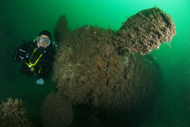
One of the major aims of the Nautical Archaeology Society (NAS) is to provide divers access to Protected Wrecks and by doing so, fostering a sense of custodianship of underwater cultural heritage. Several times each year, the NAS runs Protected Wreck Days allowing qualified divers to have an extraordinary experience visiting and learning about the UK's protected wrecks. Not only do the divers get to visit sites that require a licence to visit, they also receive a thorough dive briefing and archaeological site briefing before each dive so that they will know what to look out for and will have an understanding of the underwater site and it's place in history.
We offer two Protected Wreck Day experiences. Based out of Eastbourne, Sussex, we take divers to the Norman's Bay Wreck (c.1690) and the Holland No.5 submarine (sank 1912). The Portsmouth based experience in Hampshire goes to the protected wrecks of HMS Invincible (sank 1758) and the A1 Submarine (sank 1911). These are definitely experiences for people who are interested in 'Diving for a Purpose'.
|
50.7214
|
-1.0884
|
NULL
|
NULL
|
2021-12-14 11:38:45
|
Peta Knott
|
United Kingdom
|
 ,  |
|
3
|
|
Maritime Archaeology Trust
|
Sustainable and Resilient Coastal Cities (SARCC)
|
https://maritimearchaeologytrust.org/projects-research/sarcc-sustainable-and-resilient-coastal-cities/
|
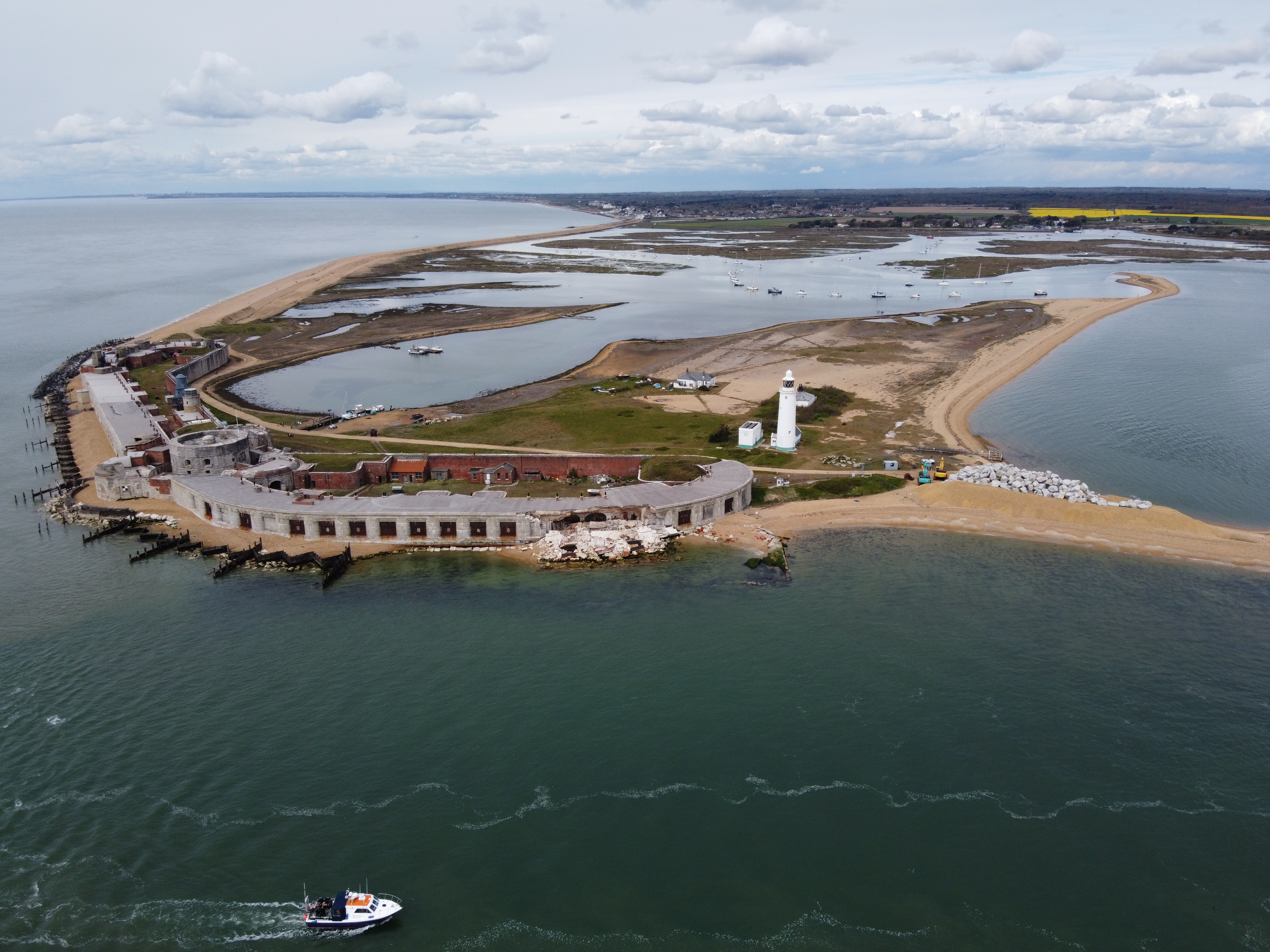
SARCC will mainstream nature-based solutions (NBS) into coastal management and policy making, where they are integrated into existing grey infrastructure and flood defences. The project builds the capacity of urban leaders, decision-makers and officers involved in coastal flood defences to deploy NBS and understand the additional benefits that they offer in comparison to traditional grey infrastructure. The project area ranges from Cornwal in southwest England, to the Flemish coastline.
MAT are assessing the under-used archaeological, historical and palaeo-environmental information as data sources to provide insights into the impact of human activities along the coastline from the early Holocene to the mid-20th century. Analysis of the material is demonstrating long-term patterns of coastal change . This knowledge is providing a positive contribution to the coastal management, decision making process and to raise stakeholder awareness. It will be particularly valuable where nature based solutions are to be reinstated and there is a desire to work in tandem with long term natural processes rather than in opposition. The outputs will contribute to the UN Decade of Ocean Science and Sustainable development and the UN sustainable development goals 11, 13 and 14.
|
50.3000
|
-1.0000
|
NULL
|
NULL
|
2021-05-31 00:55:18
|
garry.momber@maritimearchaeologytrust.org
|
United Kingdom
|
 ,  |
|
11
|
.png)
|
Nautical Archaeology Society
|
Discover Maritime Archaeology eLearning course
|
https://moodle.nauticalarchaeologysociety.org/
|
The Discover Maritime Archaeology eLearning course is the entry level to the Nautical Archaeology Society's Education Programme. No prior knowledge or training is required to complete this course. This online course allows people to learn the basic theory of maritime archaeology at their own pace. It demonstrates to participants that maritime archaeology is not just about shipwrecks, and it is certainly not all underwater.
The six modules in this course cover the following topics: introduction to maritime archaeology, site types, artefact investigation, legislation and recording and monitoring sites. The legislation module outlines the mechanisms that are in place to protect our heritage that is underwater, on the foreshore and on land. Participants will learn how this applies to visiting or investigating historic sites. There is a particular emphasis on promoting the UNESCO 2001 Convention on the Protection of the Underwater Cultural Heritage.
This theory course and accompanying practical Recorder Skills Day is the first of the two components of the NAS Foundation qualification, which will allow graduates to participate in NAS fieldwork in the UK and overseas.
|
50.7888
|
-1.0319
|
NULL
|
NULL
|
2021-12-14 12:04:16
|
Peta Knott
|
United Kingdom
|
 ,  |
|
1
|
|
Maritime Archaeology Trust
|
Bouldnor Cliff Mesolithic Occupation Site
|
https://maritimearchaeologytrust.org/projects-research/bouldnor-cliff/
|
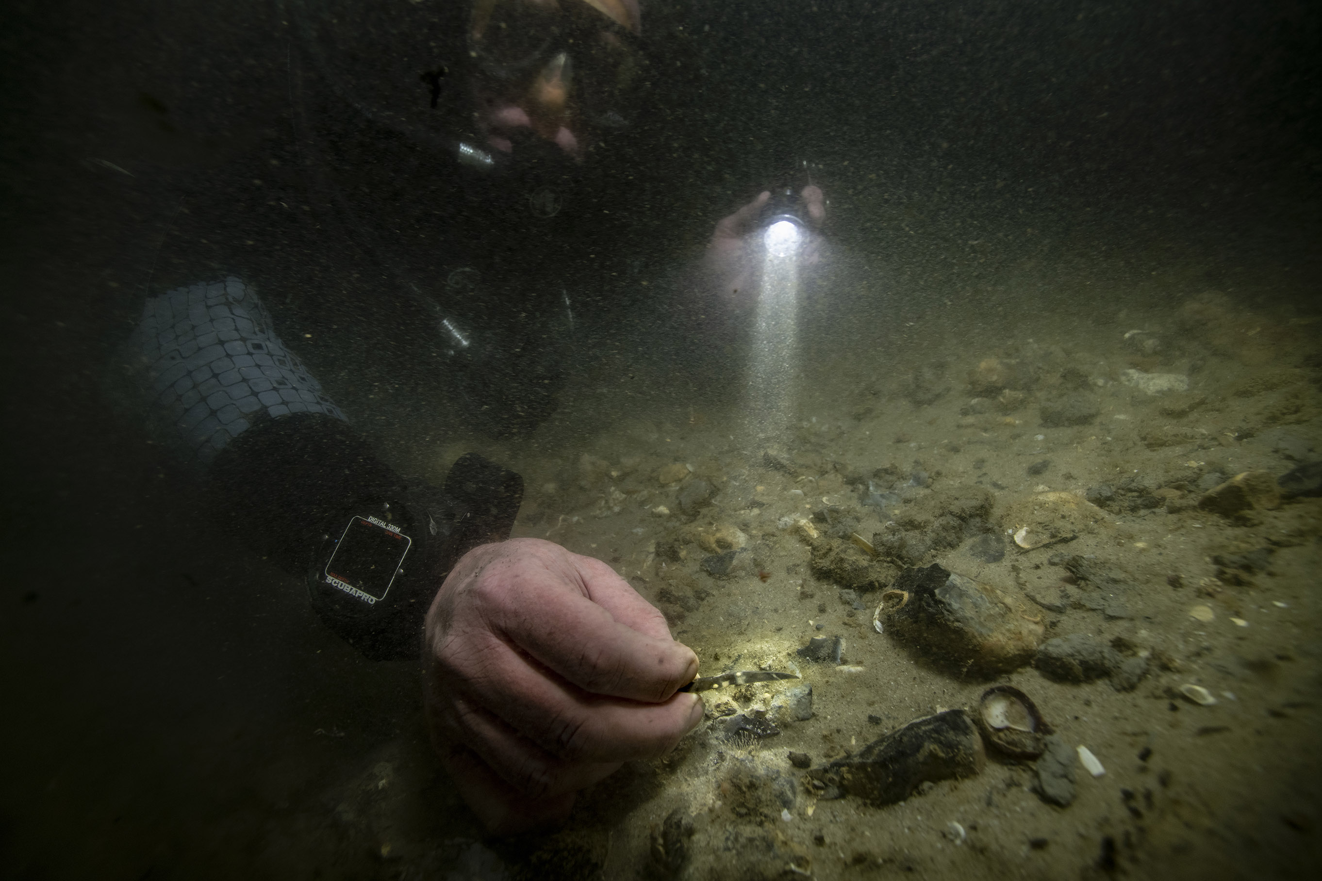
The submerged Mesolithic landscape at Bouldnor Cliff lies on the edge of the drowned palaeo-valley and is now 11m underwater, 1km east of Yarmouth on the Isle of Wight. It stretches for a further kilometre west to east and contains five known loci containing archaeological evidence. It lies within the Solent Maritime Special Area of Conservation and is in the Yarmouth to Cowes candidate Marine Conservation Zone.
|
50.1235
|
-1.2346
|
NULL
|
NULL
|
2021-05-20 17:57:14
|
brandon.mason@maritimearchaeology.co.uk
|
United Kingdom
|
 ,  |
|
24
|

|
The Ocean Foundation
|
Project Tangaroa
|
https://www.project-tangaroa.org/
|
Project Tangaroa is a collaboration between The Ocean Foundation (TOF), Lloyd’s Register Foundation, and Waves Group. It is supported through the LRF funded Threats to Our Ocean Heritage project that TOF runs and is an endorsed Decade Action. Groups involved in the project include Major Projects Foundation, ICOMOS-ICUCH, IUCN, International Maritime Organisation, and participants from the UK, Baltic, North America, Pacific, and the Arctic region.
Pollution from PPWs is a cross-border problem, affecting global society, the environment and economies. It has serious threats and negative impacts on wildlife, marine ecosystems, coastal communities (food, livelihoods, and habitability), human health and safety (Hazardous and Noxious Substances, munitions, chemicals) and locks in high costs for emergency response and remediation. Pro-active action on PPWs will reduce costs and reduce the risk and impact of these threats.
Tangaroa brings together experts for a series of workshops. The workshops convene an international network of researchers, industry experts and stakeholders to discuss this issue and by the end have developed a Global Framework for the Near- and Long-Term Assessment, Intervention and Sharing of Data for Potentially Polluting Wrecks and an International Standard and protocols for PPW assessment and intervention. The aim is to demonstrate improved methodologies for proactive risk management and cost reductions, with a technology roadmap to optimise PPW management. This tool-kit will provide assurance to stakeholders and policy makers and therefore facilitate the aggregation of multilateral finance required to boost resilience. Workshop 1 was held in London in March and served as an introduction to the project as well as in-depth discussions about the governance and regulatory framework for PPWs. The workshop had 54 in-person attendees representing 38 organisations and 11 organisations represented in online attendance. Workshop 2 was just held in Helsinki with 64 in-person and 32 online. The discussion theme was technology and methodology for PPW assessment and intervention. Workshop 3 is scheduled for March 2025, in Malta, and will focus on archives and dissemination of cultural heritage data for PPWs.
|
38.8951
|
-77.0364
|
NULL
|
NULL
|
2024-12-11 10:59:58
|
charlotte.jarvis
|
NULL
|
|
|
23
|
NULL
|
The Ocean Foundation
|
Threats to Our Ocean Heritage
|
https://hec.lrfoundation.org.uk/get-involved/threats-to-our-ocean-heritage
|
This is an ocean literacy project highlighting the threats to our Ocean Heritage, both natural and cultural, from bottom trawling, deep seabed mining, and potentially polluting wrecks. It is an endorsed Action under the UN Decade for Ocean Science.
The action consists of three open access books, four workshops on PPWs, and associated multimedia products which target both stakeholders and the general public. The action is a collaboration between The Ocean Foundation, Lloyd’s Register Foundation Heritage and Education Centre and has collaboration with other organisations such as ICOMOS-ICUCH.
One book on underwater cultural heritage and bottom trawling and one on potentially polluting wrecks was be published (May 2024) as part of the Springer Briefs in Underwater Archaeology Series. A book highlighting the threats from seabed mining will be published as an edition of ICOMOS Heritage at Risk series. The books are intended as education outreach resources that will shine a light on how these activities are threats not only to UCH but also to natural heritage. This is a call to action and includes recommending a moratoria on the activities until scientific surveys and research have been done and baseline information about our ocean heritage (natural and cultural) is integrated into Environmental Impact Assessments, Marine Spatial Planning– including the setting aside of significant natural and cultural heritage as Marine Protected Areas.
|
38.8951
|
-77.0364
|
NULL
|
NULL
|
2024-06-05 13:13:47
|
charlotte.jarvis
|
NULL
|
|


.png)


.png)

