NGO Projects
View and add records for NGO UCH projects
Additional project images can be attached to each record. Click on the symbols below to view and add as many images as are required. Upload in in bulk by pressing the 'Upload files' button. Once added, you can edit titles and copyright for all new child images.

| ID | 13 |
|---|---|
| Project Main Image | 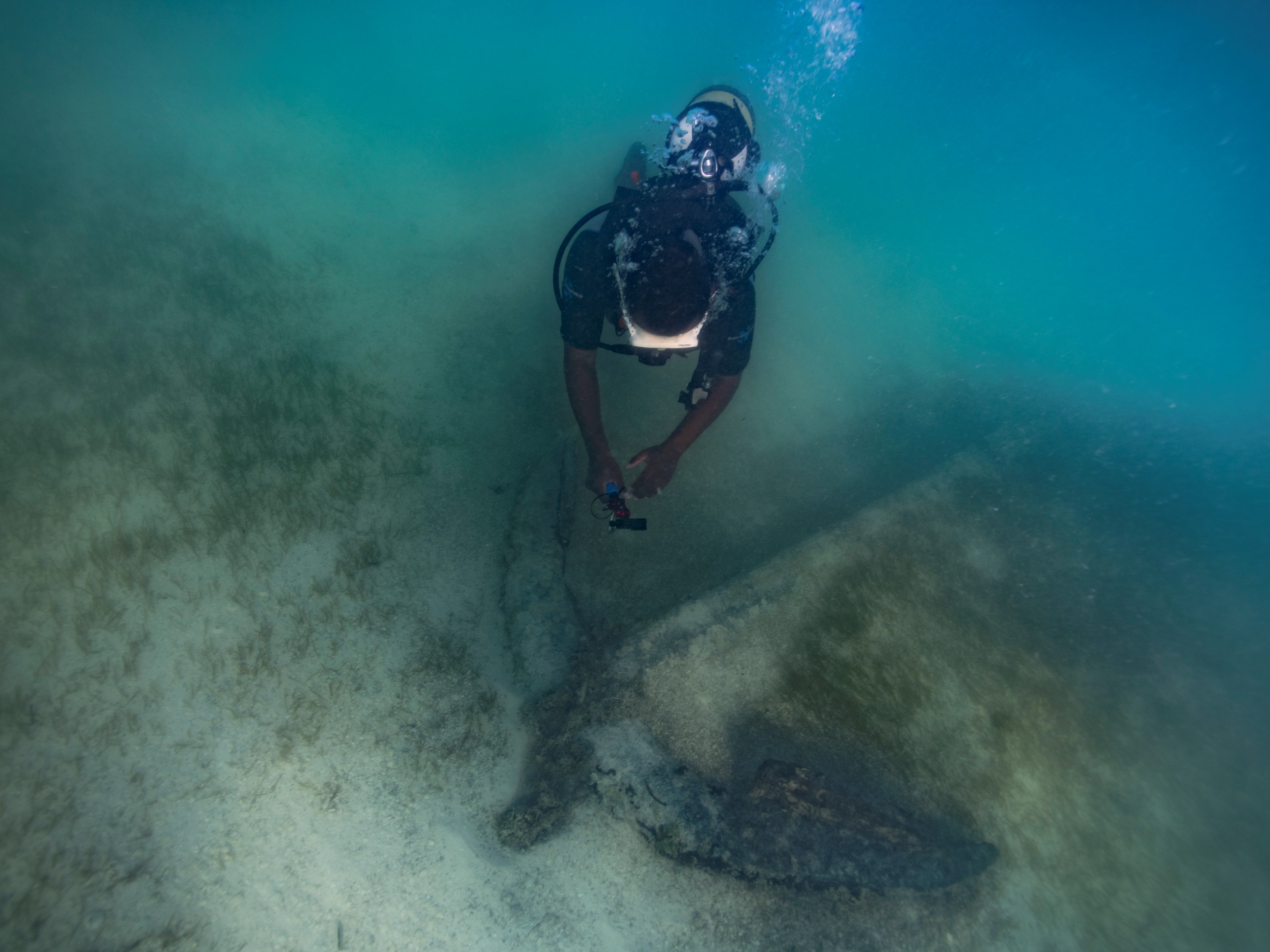 |
| Org ID | Maritime Archaeology Trust |
| Project Name | Rising from the Depths - Salary Bay, Madagascar |
| Project URL | https://risingfromthedepths.com/innovation-projects/marovany-4-4/ |
| Project Description | STUDY AND IMPLEMENTATION OF NETWORK SYSTEM BY FISHERS’ COMMUNITY ACTOR FOR THE MARINE CULTURAL HERITAGE SURVIVAL. CASE OF THE FARMING TOWNSHIP OF TSIFOTA IN SOUTHWEST OF MADAGASCAR RFTD MARKER Study and implementation of network system by fishers’ community actor for the marine cultural heritage su... more |
| Latitude (WGS84) | -22.5498 |
| Longitude (WGS84) | 43.2240 |
| Project Report | NULL |
| Video URL | NULL |
| Record Created | 2023-06-12 16:59:50 |
| Record Creator | brandon.mason@maritimearchaeology.co.uk |
| Location | Madagascar |
| Project SDGs |  , , , , , , , , , , |
| ID | 12 |
|---|---|
| Project Main Image | 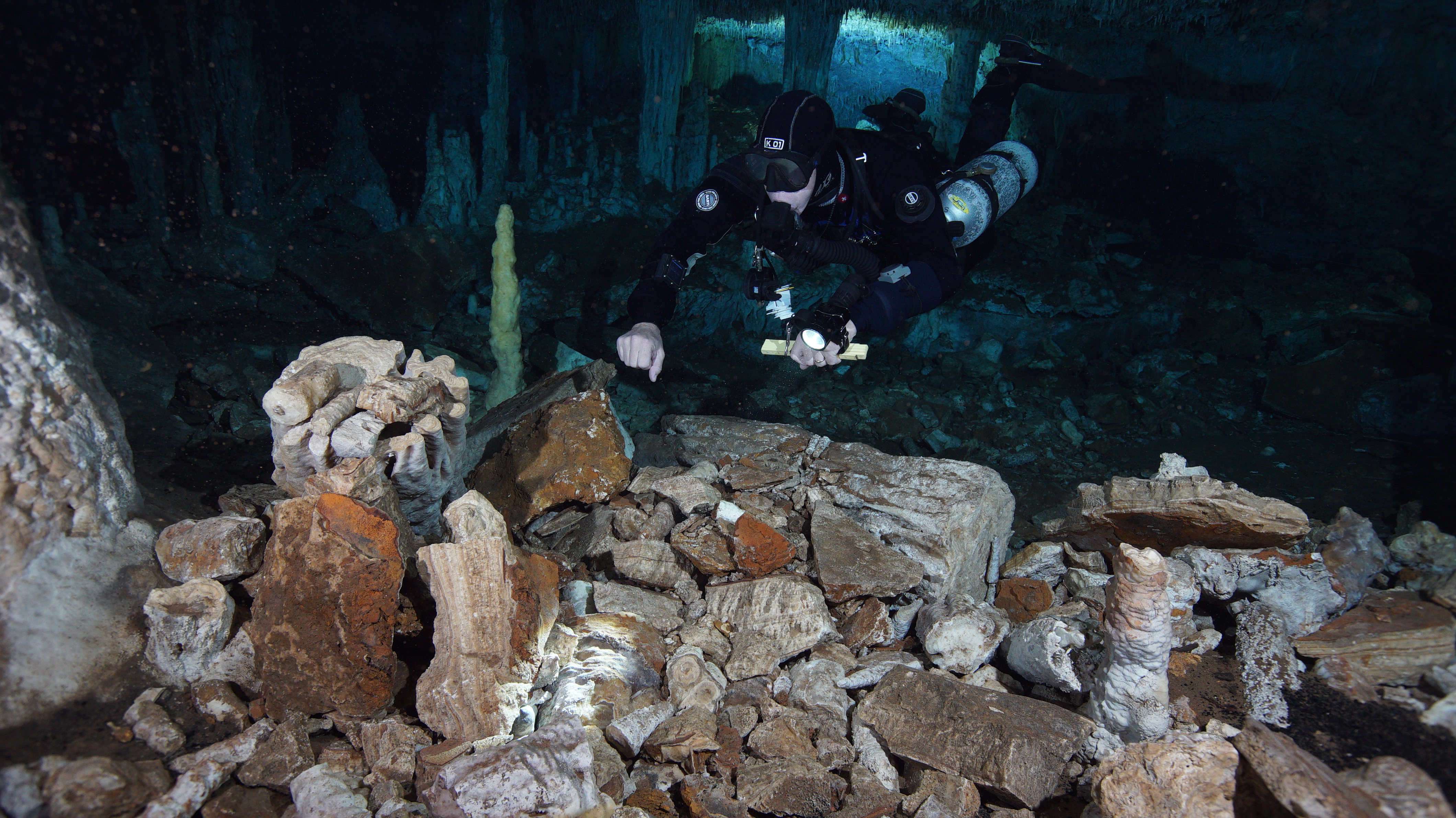 |
| Org ID | CINDAQ - Centro Investigador del Sistema Acuifero de Quintana Roo A.C. |
| Project Name | Sagitario La Mina |
| Project URL | https://www.cindaq.org/copy-of-sagitario-la-mina |
| Project Description | In 2017, CINDAQ's dive team found evidence of ancient mining activity while exploring and mapping new tunnels of an underwater cave near Akumal, Quintana Roo, Mexico. The Maya are known to have actively mined pigment and other minerals from the caves of the Yucatan Peninsula, but the ancient mine... more |
| Latitude (WGS84) | 20.6000 |
| Longitude (WGS84) | -87.4000 |
| Project Report | download |
| Video URL |  |
| Record Created | 2022-07-28 18:54:41 |
| Record Creator | cindaq |
| Location | Mexico |
| Project SDGs |
| ID | 6 |
|---|---|
| Project Main Image |  |
| Org ID | ADRAMAR |
| Project Name | The reconstructed archaeological site of Bizeux |
| Project URL | https://adramar.fr/plongee-sur-le-site-archeologique-reconstitue-de-bizeux/ |
| Project Description | The reconstructed archaeological site of Bizeux presents an 18th century privateer wreck. We discover in scuba diving or in apnea, five guns, two arranged in ballast, three arranged in battery for defensive fire; a jas anchor. This reconstructed archaeological site with real artefacts is open to all... more |
| Latitude (WGS84) | 48.6283 |
| Longitude (WGS84) | -2.0267 |
| Project Report | NULL |
| Video URL | NULL |
| Record Created | 2021-06-10 12:53:40 |
| Record Creator | HOYAU BERRY Anne |
| Location | France |
| Project SDGs | NULL |
| ID | 5 |
|---|---|
| Project Main Image |  |
| Org ID | ADRAMAR |
| Project Name | Epave du Fetlar |
| Project URL | https://play.google.com/store/apps/details?id=fr.eesab.dpn.fetlard&hl=fr&gl=US |
| Project Description | 3D scanning of the wreck of the Fetlar, wrecked in 1919, off Saint-Malo (Brittany, France). The photogrammetry technique allowed a 3D rendering of the wreck and the implementation of an immersive virtual dive. This technique also allows the archaeological recording of the wreck. |
| Latitude (WGS84) | 48.6845 |
| Longitude (WGS84) | -2.0727 |
| Project Report | NULL |
| Video URL | NULL |
| Record Created | 2021-06-10 13:07:39 |
| Record Creator | HOYAU BERRY Anne |
| Location | France |
| Project SDGs | NULL |
| ID | 26 |
|---|---|
| Project Main Image | 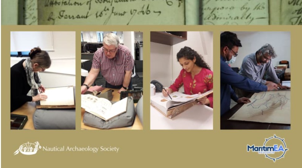 |
| Org ID | MaritimEA Research |
| Project Name | Pakistan Shipwreck Archive Project |
| Project URL | https://maritimea.org/pakistan-shipwreck-archive-project-psap/ |
| Project Description | MaritimEA is undertaking the Pakistan Shipwreck Archive Project to develop an archive of known historical shipwrecks in Pakistani waters. A first step towards building this archive is the "Wrecks and Records: Building Pakistan's Maritime Past" initiative, bringing together International researcher... more |
| Latitude (WGS84) | 24.7516 |
| Longitude (WGS84) | 67.5227 |
| Project Report | NULL |
| Video URL | NULL |
| Record Created | 2026-06-10 09:22:07 |
| Record Creator | Amer Bazl Khan |
| Location | Pakistan |
| Project SDGs | ,, |
| ID | 25 |
|---|---|
| Project Main Image | 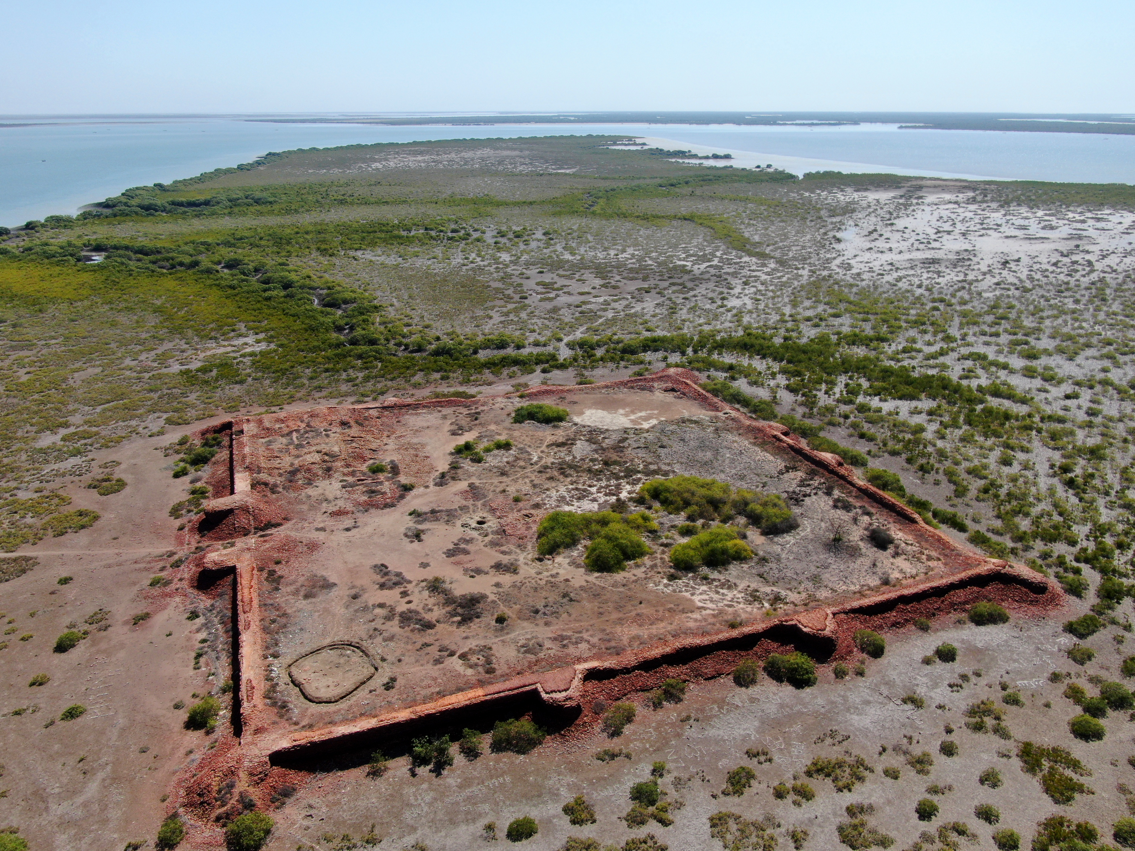 |
| Org ID | MaritimEA Research |
| Project Name | Digital Heritage Trails Project |
| Project URL | http://www.lostcitiesofthedelta.org |
| Project Description | MaritimEA is undertaking a project titled “The Digital Heritage Trails Project” (DHTP). The project involves the documentation of endangered archaeological sites in the Indus Delta region, including Banbhore, Ratukot, Jam Jaskar Goth, Ranokot, and Lahiri Bandar. DHTP has developed high-precision 3D ... more |
| Latitude (WGS84) | 24.7516 |
| Longitude (WGS84) | 67.5227 |
| Project Report | NULL |
| Video URL |  |
| Record Created | 2025-03-26 02:48:10 |
| Record Creator | Amer Bazl Khan |
| Location | Pakistan |
| Project SDGs | ,,,,, |
| ID | 8 |
|---|---|
| Project Main Image | 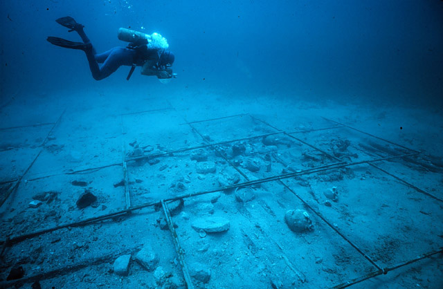 |
| Org ID | Institute of Nautical Archaeology |
| Project Name | Ancient and Early Modern Shipwrecks in the Mediterranean |
| Project URL | https://nauticalarch.org/projects/ |
| Project Description | The Institute of Nautical Archaeology has been actively excavating shipwrecks in the Mediterranean for more than four decades. Notable shipwrecks include those at: Cape Gelidonya, Uluburun, Pabuç Burnu, Tektaş Burnu, Yassıada, Kizilburun, and Serçe Limani. Many of these shipwrecks are displayed in... more |
| Latitude (WGS84) | 37.0344 |
| Longitude (WGS84) | 27.4305 |
| Project Report | NULL |
| Video URL | NULL |
| Record Created | 2021-07-19 16:51:35 |
| Record Creator | ina |
| Location | Turkey |
| Project SDGs | |
| ID | 22 |
|---|---|
| Project Main Image | NULL |
| Org ID | Rhode Island Marine Archaeology Project |
| Project Name | The Vessels Lost in RI during the Revolutionary War - Part III |
| Project URL | https://www.rimap.org/the-other-vessels |
| Project Description | RIMAP’s study of the Newport transport fleet has generated a great amount of international interest in local maritime history because one of the vessels, the Lord Sandwich, had been Capt. Cook’s Endeavour Bark of his first circumnavigation. RIMAP’s historical studies of the transports overturned th... more |
| Latitude (WGS84) | 0.0000 |
| Longitude (WGS84) | 0.0000 |
| Project Report | NULL |
| Video URL | NULL |
| Record Created | 2024-06-03 23:51:09 |
| Record Creator | snelsonmaney |
| Location | United States of America |
| Project SDGs | , |
| ID | 21 |
|---|---|
| Project Main Image | NULL |
| Org ID | Rhode Island Marine Archaeology Project |
| Project Name | The Vessels Lost in RI during the Revolutionary War - Part II |
| Project URL | https://www.rimap.org/the-other-vessels |
| Project Description | RIMAP’s very first archaeological fieldwork in 1993 was a sonar survey to locate the fleet of 13 privately-owned British transports scuttled in Newport’s Outer Harbor August 5-9, 1778, in the days leading up to the Battle of Rhode Island in the American Revolution. In the years since, continued remo... more |
| Latitude (WGS84) | 0.0000 |
| Longitude (WGS84) | 0.0000 |
| Project Report | NULL |
| Video URL | NULL |
| Record Created | 2024-06-03 23:49:42 |
| Record Creator | snelsonmaney |
| Location | United States of America |
| Project SDGs | , |
| ID | 20 |
|---|---|
| Project Main Image | NULL |
| Org ID | Rhode Island Marine Archaeology Project |
| Project Name | The Vessels Lost in RI during the Revolutionary War - Part I |
| Project URL | https://www.rimap.org/the-other-vessels |
| Project Description | RIMAP’s early studies of the ships lost in local waters during the American Revolution included preliminary studies of HMS Lark, Cerberus, and Orpheus, three of the four Royal Navy frigates intentionally destroyed along the western shore of Aquidneck Island on August 5, 1778. Sonar searches to find ... more |
| Latitude (WGS84) | 0.0000 |
| Longitude (WGS84) | 0.0000 |
| Project Report | NULL |
| Video URL | NULL |
| Record Created | 2024-06-03 23:48:10 |
| Record Creator | snelsonmaney |
| Location | United States of America |
| Project SDGs | , |
| ID | 19 |
|---|---|
| Project Main Image | NULL |
| Org ID | Rhode Island Marine Archaeology Project |
| Project Name | Newport's Brenton Cove |
| Project URL | https://www.rimap.org/the-other-vessels |
| Project Description | There are four vessels known to have been abandoned in Newport’s Brenton Cove, one of which was the reputed Slave Ship Gem. RIMAP teams described the physical remains of these ships, including the one insecurely identified as a slaver that was abandoned there after the Civil War. Historical studies ... more |
| Latitude (WGS84) | 0.0000 |
| Longitude (WGS84) | 0.0000 |
| Project Report | NULL |
| Video URL | NULL |
| Record Created | 2024-06-03 23:46:26 |
| Record Creator | snelsonmaney |
| Location | United States of America |
| Project SDGs | , |
| ID | 18 |
|---|---|
| Project Main Image | NULL |
| Org ID | Rhode Island Marine Archaeology Project |
| Project Name | RI 2130 - The Fort Adams Marine Railway |
| Project URL | https://www.rimap.org/new-page |
| Project Description | Fort Adams is an early 19th-century US Army fort that in the 20th century sponsored a shipyard to repair and service the vessels that supported the troops stationed there. The shipyard included a marine railway used to draw out of the water craft as long as 100’ and after repair to return them to ac... more |
| Latitude (WGS84) | 0.0000 |
| Longitude (WGS84) | 0.0000 |
| Project Report | NULL |
| Video URL | NULL |
| Record Created | 2024-06-03 23:43:55 |
| Record Creator | snelsonmaney |
| Location | United States of America |
| Project SDGs | , |
| ID | 17 |
|---|---|
| Project Main Image | NULL |
| Org ID | Rhode Island Marine Archaeology Project |
| Project Name | The Ships of Namquid/Gaspee Point |
| Project URL | https://www.rimap.org/the-other-vessels |
| Project Description | Rhode Island patriots attacked and burned HMS Gaspee in 1772 in response to increasing British interference in local trade. RIMAP began a study of this area in 2015, starting with two 19th-century vessels in the area. As part of its citizen scientist training program, the teams documented the curre... more |
| Latitude (WGS84) | 0.0000 |
| Longitude (WGS84) | 0.0000 |
| Project Report | NULL |
| Video URL | NULL |
| Record Created | 2024-06-03 23:39:06 |
| Record Creator | snelsonmaney |
| Location | United States of America |
| Project SDGs | , |
| ID | 9 |
|---|---|
| Project Main Image | 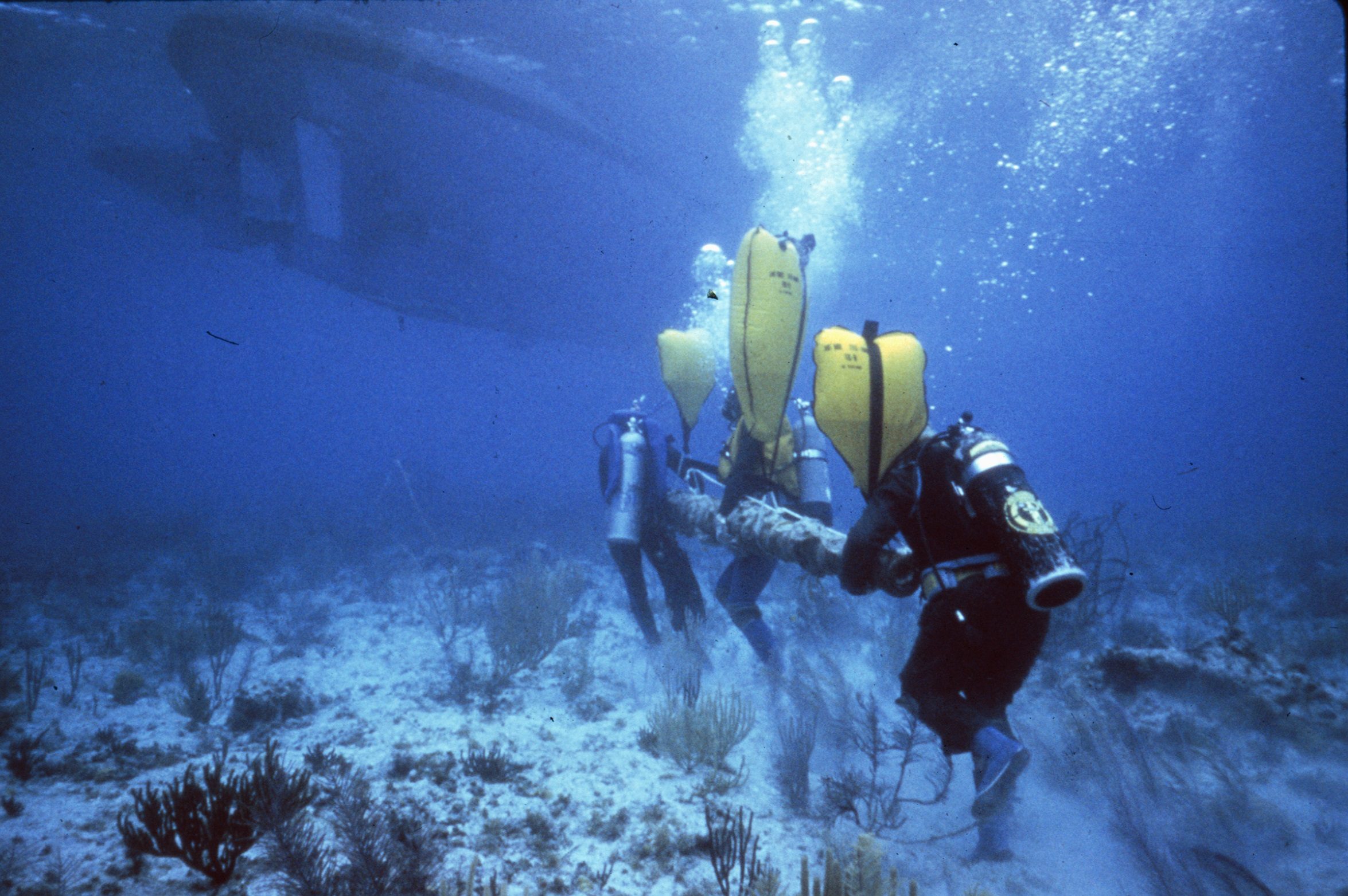 |
| Org ID | Institute of Nautical Archaeology |
| Project Name | Shipwrecks in North America and the Caribbean |
| Project URL | https://nauticalarch.org/projects/ |
| Project Description | Since the 1970s, the Institute of Nautical Archaeology has sponsored and/or directed many underwater excavations in North America and the Caribbean, including those at: Port Royal (Jamaica), Molasses Reef (Turks and Caicos), Rockley Bay (Tobago), Monte Cristi (Dominican Republic), Red River (Oklaho... more |
| Latitude (WGS84) | 30.6188 |
| Longitude (WGS84) | 96.3365 |
| Project Report | NULL |
| Video URL | NULL |
| Record Created | 2021-07-19 13:36:33 |
| Record Creator | ina |
| Location | United States of America |
| Project SDGs | |
| ID | 27 |
|---|---|
| Project Main Image |  |
| Org ID | Maritime Archaeology Sea Trust (MAST) |
| Project Name | HMS Invincible |
| Project URL | https://www.thisismast.org/projects/hms-invincible.html |
| Project Description | Thanks to over £2.5 million of funding from LIBOR and the National Lottery Heritage Fund in the UK, MAST led a major rescue excavation of the first HMS Invincible, with partners Bournemouth University and site archaeologist and licensee, Dr Dan Pascoe. She sank in the Solent off Portsmouth in 1758. ... more |
| Latitude (WGS84) | 50.7395 |
| Longitude (WGS84) | -1.0384 |
| Project Report | NULL |
| Video URL | NULL |
| Record Created | 2026-06-10 10:25:15 |
| Record Creator | MAST |
| Location | United Kingdom |
| Project SDGs | NULL |
| ID | 16 |
|---|---|
| Project Main Image |  |
| Org ID | Nautical Archaeology Society |
| Project Name | International Training Partner Scheme |
| Project URL | https://www.nauticalarchaeologysociety.org/Pages/Category/international-system |
| Project Description | We support organisations from around the world in teaching best practices in underwater cultural heritage through our International Training Partner Programme. These organisations have a licence to teach a local version of our accredited training programme which has a core module on UCH legislation ... more |
| Latitude (WGS84) | 50.7888 |
| Longitude (WGS84) | -1.0319 |
| Project Report | NULL |
| Video URL | NULL |
| Record Created | 2023-08-24 13:51:10 |
| Record Creator | Peta Knott |
| Location | United Kingdom |
| Project SDGs | ,, |
| ID | 15 |
|---|---|
| Project Main Image |  |
| Org ID | Nautical Archaeology Society |
| Project Name | Identifying Explosive and Environmental Hazards on Wrecks |
| Project URL | https://moodle.nauticalarchaeologysociety.org/ |
| Project Description | Learn how to safely dive on military wrecks and help to identify environmental and explosive hazards on wrecks. This course is a pre-requisite for NAS MOD diving projects. |
| Latitude (WGS84) | 50.7888 |
| Longitude (WGS84) | -1.0319 |
| Project Report | NULL |
| Video URL | NULL |
| Record Created | 2023-08-24 13:38:24 |
| Record Creator | Peta Knott |
| Location | United Kingdom |
| Project SDGs | ,, |
| ID | 14 |
|---|---|
| Project Main Image |  |
| Org ID | Nautical Archaeology Society |
| Project Name | HMS Natal |
| Project URL | https://www.nauticalarchaeologysociety.org/mod-wreck-assessments |
| Project Description | The Ministry of Defence (MOD) has multiple historic shipwrecks in UK waters and little is known about the condition of many of these wreck sites. Consequently, the Nautical Archaeology Society (NAS) carried out a programme of non-intrusive condition assessments using the HMS Natal in the Cromarty Fi... more |
| Latitude (WGS84) | 57.6959 |
| Longitude (WGS84) | -4.0891 |
| Project Report | NULL |
| Video URL | NULL |
| Record Created | 2023-08-24 13:29:44 |
| Record Creator | Peta Knott |
| Location | United Kingdom |
| Project SDGs |
| ID | 4 |
|---|---|
| Project Main Image | 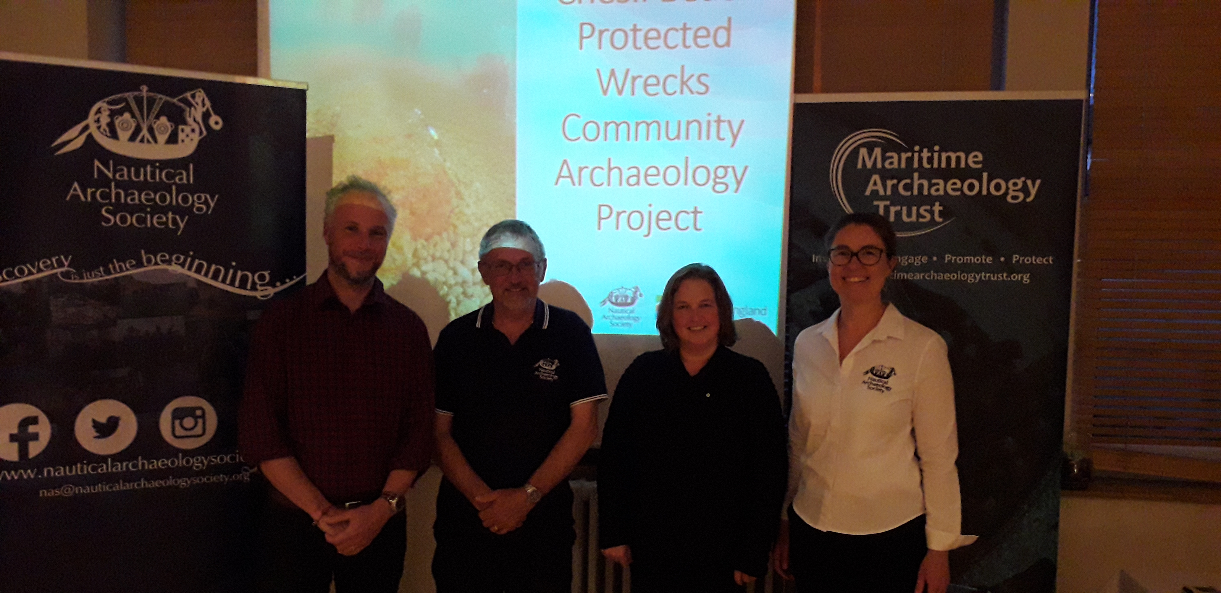 |
| Org ID | Maritime Archaeology Trust |
| Project Name | Chesil Beach Project |
| Project URL | https://www.nauticalarchaeologysociety.org/chesil-beach-protected-wrecks |
| Project Description | Chesil Beach Protected Wrecks Community Archaeology Project In 2019 the Nautical Archaeology Society (NAS) and the Maritime Archaeology Trust (MAT) ran training activities and series of public events based around the Chesil Beach protected wrecks off the coast of Weymouth. Activities were held i... more |
| Latitude (WGS84) | 50.3628 |
| Longitude (WGS84) | -2.3205 |
| Project Report | NULL |
| Video URL | NULL |
| Record Created | 2021-06-05 04:30:36 |
| Record Creator | Peta Knott |
| Location | United Kingdom |
| Project SDGs |  ,, ,, |
| ID | 10 |
|---|---|
| Project Main Image | 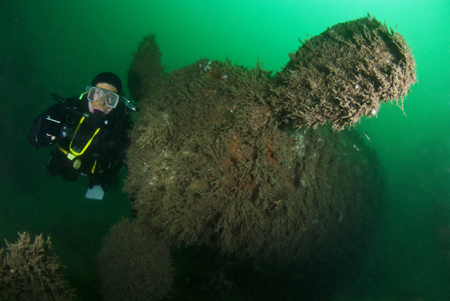 |
| Org ID | Nautical Archaeology Society |
| Project Name | Protected Wreck Days |
| Project URL | https://www.nauticalarchaeologysociety.org/protected-wreck-days |
| Project Description | One of the major aims of the Nautical Archaeology Society (NAS) is to provide divers access to Protected Wrecks and by doing so, fostering a sense of custodianship of underwater cultural heritage. Several times each year, the NAS runs Protected Wreck Days allowing qualified divers to have an extraor... more |
| Latitude (WGS84) | 50.7214 |
| Longitude (WGS84) | -1.0884 |
| Project Report | NULL |
| Video URL | NULL |
| Record Created | 2021-12-14 11:38:45 |
| Record Creator | Peta Knott |
| Location | United Kingdom |
| Project SDGs | , |