NGO Projects
View and add records for NGO UCH projects
Additional project images can be attached to each record. Click on the symbols below to view and add as many images as are required. Upload in in bulk by pressing the 'Upload files' button. Once added, you can edit titles and copyright for all new child images.

| ID | 3 |
|---|---|
| Project Main Image | 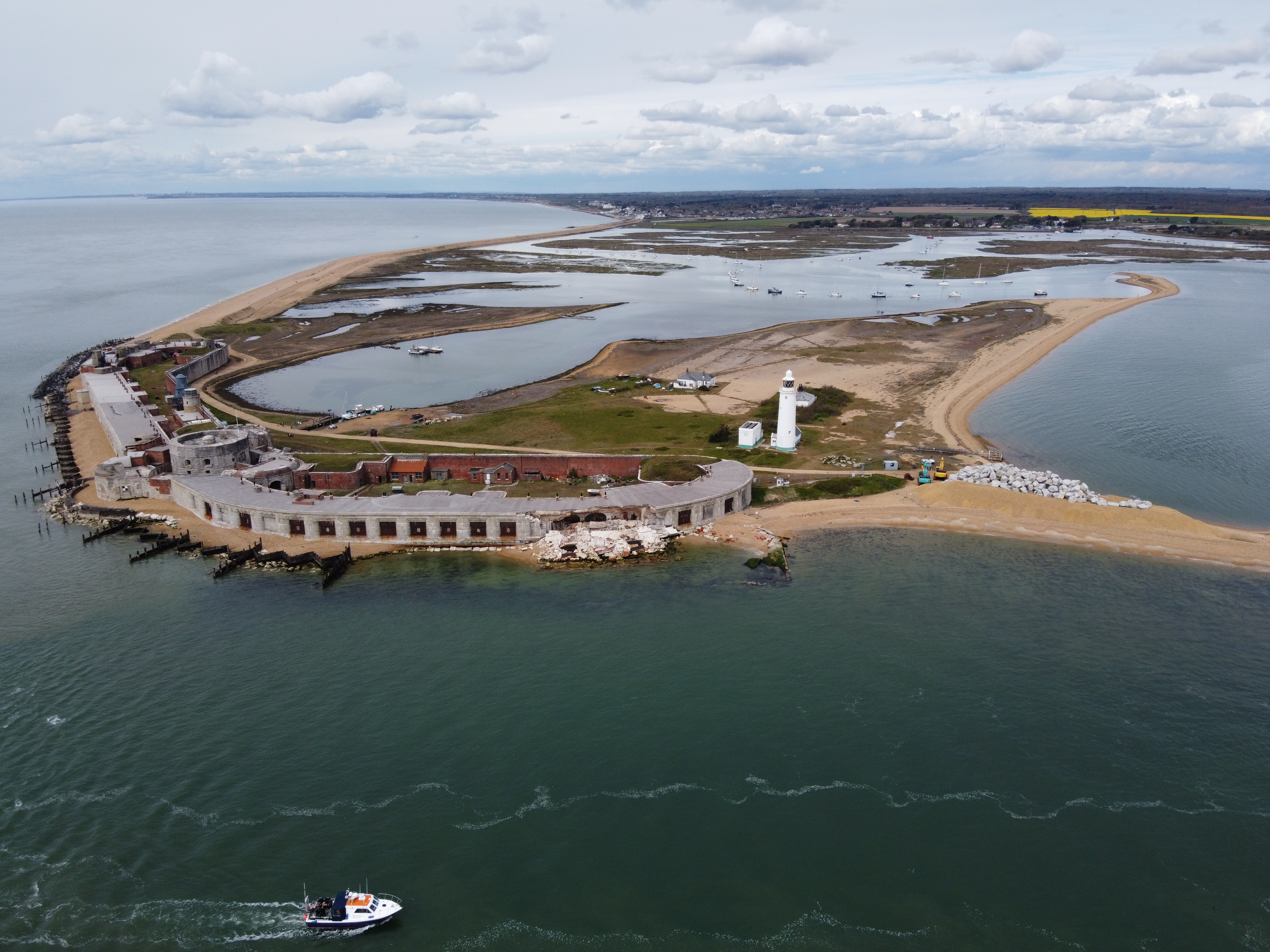 |
| Org ID | Maritime Archaeology Trust |
| Project Name | Sustainable and Resilient Coastal Cities (SARCC) |
| Project URL | https://maritimearchaeologytrust.org/projects-research/sarcc-sustainable-and-resilient-coastal-cities/ |
| Project Description | SARCC will mainstream nature-based solutions (NBS) into coastal management and policy making, where they are integrated into existing grey infrastructure and flood defences. The project builds the capacity of urban leaders, decision-makers and officers involved in coastal flood defences to deploy NB... more |
| Latitude (WGS84) | 50.3000 |
| Longitude (WGS84) | -1.0000 |
| Project Report | NULL |
| Video URL | NULL |
| Record Created | 2021-05-31 00:55:18 |
| Record Creator | garry.momber@maritimearchaeologytrust.org |
| Location | United Kingdom |
| Project SDGs |  , , |
| ID | 11 |
|---|---|
| Project Main Image | .png) |
| Org ID | Nautical Archaeology Society |
| Project Name | Discover Maritime Archaeology eLearning course |
| Project URL | https://moodle.nauticalarchaeologysociety.org/ |
| Project Description | The Discover Maritime Archaeology eLearning course is the entry level to the Nautical Archaeology Society's Education Programme. No prior knowledge or training is required to complete this course. This online course allows people to learn the basic theory of maritime archaeology at their own pace. I... more |
| Latitude (WGS84) | 50.7888 |
| Longitude (WGS84) | -1.0319 |
| Project Report | NULL |
| Video URL | NULL |
| Record Created | 2021-12-14 12:04:16 |
| Record Creator | Peta Knott |
| Location | United Kingdom |
| Project SDGs |  , , |
| ID | 1 |
|---|---|
| Project Main Image | 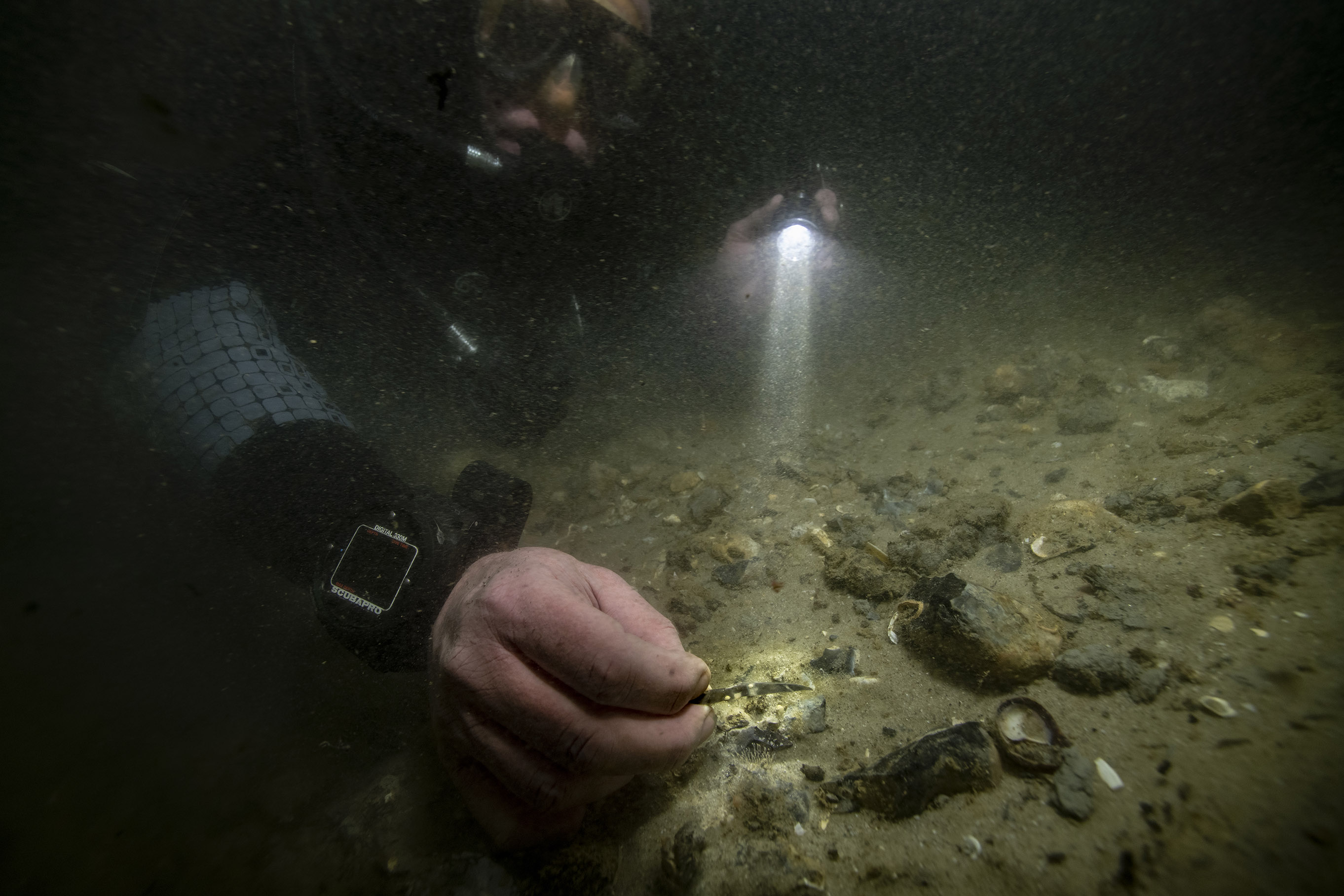 |
| Org ID | Maritime Archaeology Trust |
| Project Name | Bouldnor Cliff Mesolithic Occupation Site |
| Project URL | https://maritimearchaeologytrust.org/projects-research/bouldnor-cliff/ |
| Project Description | The submerged Mesolithic landscape at Bouldnor Cliff lies on the edge of the drowned palaeo-valley and is now 11m underwater, 1km east of Yarmouth on the Isle of Wight. It stretches for a further kilometre west to east and contains five known loci containing archaeological evidence. It lies within t... more |
| Latitude (WGS84) | 50.1235 |
| Longitude (WGS84) | -1.2346 |
| Project Report | NULL |
| Video URL | NULL |
| Record Created | 2021-05-20 17:57:14 |
| Record Creator | brandon.mason@maritimearchaeology.co.uk |
| Location | United Kingdom |
| Project SDGs | , |
| ID | 24 |
|---|---|
| Project Main Image |  |
| Org ID | The Ocean Foundation |
| Project Name | Project Tangaroa |
| Project URL | https://www.project-tangaroa.org/ |
| Project Description | Project Tangaroa is a collaboration between The Ocean Foundation (TOF), Lloyd’s Register Foundation, and Waves Group. It is supported through the LRF funded Threats to Our Ocean Heritage project that TOF runs and is an endorsed Decade Action. Groups involved in the project include Major Projects Fo... more |
| Latitude (WGS84) | 38.8951 |
| Longitude (WGS84) | -77.0364 |
| Project Report | NULL |
| Video URL | NULL |
| Record Created | 2024-12-11 10:59:58 |
| Record Creator | charlotte.jarvis |
| Location | NULL |
| Project SDGs | |
| ID | 23 |
|---|---|
| Project Main Image | NULL |
| Org ID | The Ocean Foundation |
| Project Name | Threats to Our Ocean Heritage |
| Project URL | https://hec.lrfoundation.org.uk/get-involved/threats-to-our-ocean-heritage |
| Project Description | This is an ocean literacy project highlighting the threats to our Ocean Heritage, both natural and cultural, from bottom trawling, deep seabed mining, and potentially polluting wrecks. It is an endorsed Action under the UN Decade for Ocean Science. The action consists of three open access books,... more |
| Latitude (WGS84) | 38.8951 |
| Longitude (WGS84) | -77.0364 |
| Project Report | NULL |
| Video URL | NULL |
| Record Created | 2024-06-05 13:13:47 |
| Record Creator | charlotte.jarvis |
| Location | NULL |
| Project SDGs | ,, |